|
Veros Veros Disaster Risk Program
maintains an ongoing flow of information from Federal Emergency Agency (FEMA) and
other national, regional and local sources to provide additional due diligence to
verify the potential damage to the property. Part of this program includes the Disaster
Analysis Report and DisasterWatch.
Disaster Analysis Report
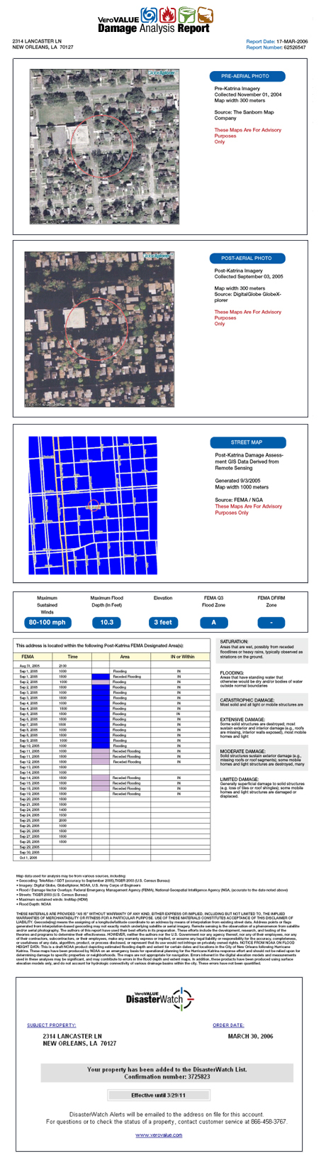
-
Immediately delivers “Before &
After” satellite or aerial photographs of the subject property complete with surrounding
streets
-
A FEMA designated street map that
provides overlays of hazard information with detailed mapping of subject property
and immediate surrounding area
-
Complete description of the type and
severity of the hazard or damage
-
Covers a wide variety of disasters
and hazards: wildfire conditions, earthquake epicenter, tropical storm path or tornado
proximity, maximum sustained wind, flooding depth and the length of time the hazard
is effecting the property
DisasterWatch
-
Receive automatic warning alerts and
Disaster Analysis Reports on this property for a period of 5 years
 download a PDF sample Disaster Analysis Report
>>
Back to report list
|